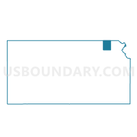
Sabatha Ward Exclave, Nemaha County, Kansas
About
Outline

Summary
| Unique Area Identifier | 586103 |
| Name | Sabatha Ward Exclave |
| County | Nemaha County |
| State | Kansas |
| Area (square miles) | 0.00 |
| Land Area (square miles) | 0.00 |
| Water Area (square miles) | 0.00 |
| % of Land Area | 100.00 |
| % of Water Area | 0.00 |
| Latitude of the Internal Point | 39.90359350 |
| Longtitude of the Internal Point | -95.81408410 |
Maps

Graphs
Select a template below for downloading or customizing gragh for Sabatha Ward Exclave, Nemaha County, Kansas